The eddy covariance technique has become a popular tool for evaluating net CO2 exchange from terrestrial ecosystems to the atmosphere, and in recent years, it has been tested for its potential ability to detect CO2 releases from underground storage reservoirs. Instruments mounted on towers above the land surface are used to measure CO2 gas concentration, vertical wind speed, relative humidity, and temperature. Carbon dioxide flux is then calculated from these field measurements based on the covariance of CO2 concentration and instantaneous vertical wind velocity above or below their mean values. Depending on the height of the towers, the resulting CO2 flux estimates provide a spatial average for an area of up to several square kilometers. Data can be integrated over the time period of interest, which may be several days to a year or more.1National Energy Technology Laboratory. (2017). Best practices: Monitoring, verification, and accounting (MVA) for geologic storage projects. National Energy Technology Laboratory, U.S. Department of Energy. https://netl.doe.gov/sites/default/files/2018-10/BPM-MVA-2012.pdf
Surface Flux Tool Summary
- Description: Flux measurement technique used to measure atmospheric CO2 concentrations at a specified height above the ground surface.
- Benefits: Can provide continuous data, averaged over both time and space, over a large area (hundreds of meters to several kilometers).
- Challenges: Specialized equipment and robust data processing are required. Natural spatial and temporal variability in CO2 flux may mask release signal.2National Energy Technology Laboratory. (2017). Best practices: Monitoring, verification, and accounting (MVA) for geologic storage projects. National Energy Technology Laboratory, U.S. Department of Energy. https://netl.doe.gov/sites/default/files/2018-10/BPM-MVA-2012.pdf

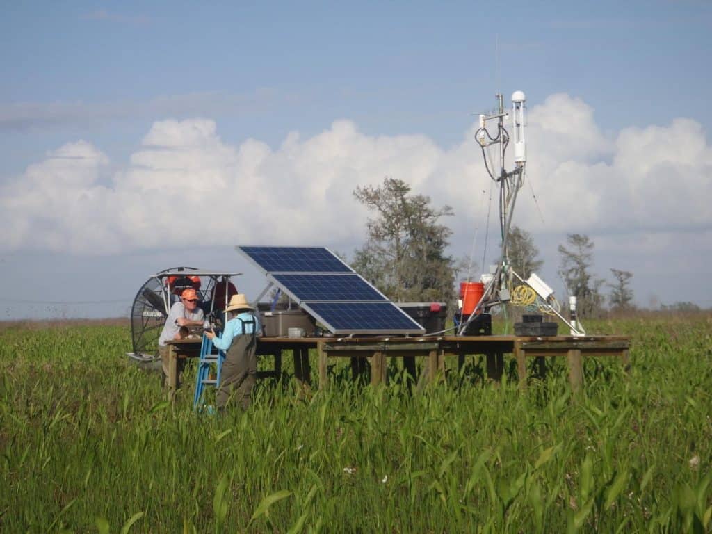
U.S. Geological Survey scientists service an eddy covariance station located in a tidal freshwater marsh in Louisiana. These stations allow agency scientists to assess the net exchange of CO2 and CH4 from wetlands over large spatial scales, and help determine the carbon sequestration capacity of managed marshes. These techniques can also be adapted to monitor carbon storage sites.3Image: Ken W. Krauss, U.S. Geological Survey

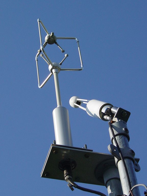
An eddy covariance system situated atop a tower, consisting of an ultrasonic anemometer (upper left) to measure three-dimensional air flow and infrared gas analyzer (lower right) to measure CO2.4Eddy Covariance. (2021, May 15). In Wikipedia. https://en.wikipedia.org/wiki/Eddy_covariance
Application
The eddy covariance method is a micrometeorological technique for direct measurements of gas transport between the surface and the atmosphere. It is widely used for quantifying CO2 emission rates from natural, urban and agricultural ecosystems, including areas of agricultural carbon sequestration. In geological carbon storage projects, the method can be an important monitoring tool in large areas where CO2 may escape from the subsurface to detect and quantify CO2 leakage.5George B., Rodney M., & Feese, K. (2013). Eddy Covariance Method for CO2 Emission Measurements in CCUS Applications: Principles, Instrumentation and Software. Energy Procedia. 40, 329-336.
Eddy covariance stations allow direct automated measurements of the gas emissions from a specific territory reported in weight or volume of gas per unit area per unit time. Industrial applications, such as a CO2 storage project, often involve large territories with complex surfaces, so more than one station may be required for confident measurements of fluxes from these large areas.6George B., Rodney M., & Feese, K. (2013). Eddy Covariance Method for CO2 Emission Measurements in CCUS Applications: Principles, Instrumentation and Software. Energy Procedia. 40, 329-336.
An example of a novel use of the eddy covariance method for monitoring is at the Archer Daniels Midland Company’s carbon storage project in Decatur, Illinois. An eddy covariance system has been in use since June 2009. Baseline data from eddy covariance monitoring was used to characterize pre-injection conditions, and was then used to look for any changes in net exchange CO2 fluxes that could be the result of CO2 leakage into the near-surface environment during or following injection.7Finley, R.J. (2012, May 16). MVA at a 1-million tonne demonstration of carbon sequestration from a biofuel source: The Illinois Basin – Decatur Project [IBDP]. Illinois State Geological Survey. https://www.slideshare.net/globalccs/illinois-basin-decatur-project-usa-13735633 No anomalies related to CO2 injection were identified as part of eddy covariance and related monitoring at the carbon storage project in Decatur.


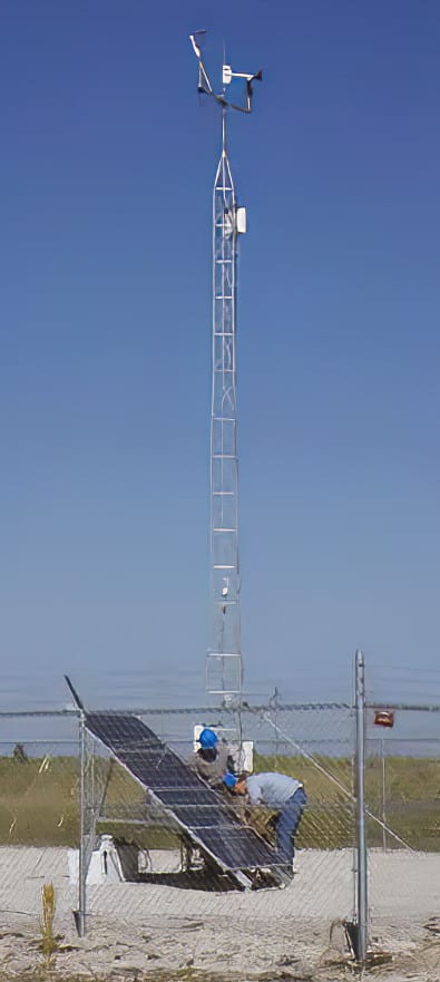
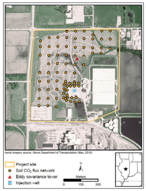
Eddy covariance monitoring station at the Archer Daniels Midland Company’s carbon storage project in Decatur, Illinois (left)8Finley, R.J. (2009, October 28). Overview of the Decatur-Illinois Basin Site. ISTC Greenhouse Gas and Sustainability Symposium. https://www.yumpu.com/en/document/view/14756129/update-on-carbon-sequestration-project-rob-finley-illinois-state and map (right) showing location of the eddy covariance tower (red triangle) and CO2 injection well (blue square).9Locke II, R. A., Krapac, I. G., Lewicki, J. L., & Curtis-Robinson, E. (2011). Characterizing near-surface CO2 conditions before injection–Perspectives from a CCS project in the Illinois Basin, USA. Energy Procedia, 4, 3306-3313.
Image Credits
- surface flux image 1: Ken W. Krauss, U.S. Geological Survey
- Surface-flux-monitoring-Eddy-covariance-Decatur-EDIT: National Energy Technology Laboratory